The Earth’s polar vortex is stirring up, bringing the first hints of changing weather as the autumn foliage starts to turn and the temperatures begin to drop.
The movement means gradual cooling and a more active storm track across the northern U.S.; but not everyone will feel the chill right away.
In Pennsylvania, dry and warm weather is still hanging around, but forecasts say overnight temps will start dipping into the 30s and 40s across parts of the state.
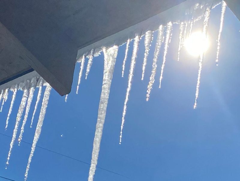
The first frost date is the average day when termperatures in your area drop to 32 degrees, cold enough to threaten or kill tender plants.
When will it get cold in Pennsylvania?
The Climate Prediction Center’s outlook shows above-normal temperatures across Pennsylvania through December, although the transition to La Niña could change that, bringing more frigid air to the state in December.
North Central and Northeastern parts of Pennsylvania have already marked several frigid days last month, the coldest dropping to 43 degrees on Sept. 8, according to the National Weather Service.
According to the Almanac, here is when several major cities sees its first frost, or temperatures dipping below 32 degrees.
- Erie: first fall frost typically occurs by Oct. 30 and the last spring frost occurs by May 2
- Pittsburgh: first fall frost typically occurs by Oct. 21 and the last spring frost occurs by April 30
- Philadelphia: first fall frost typically occurs by Nov. 11 and the last spring frost occurs by April 4
- Allentown: first fall frost typically occurs by Oct. 17 and the last spring frost occurs by April 26
- Reading: first fall frost typically occurs by Oct. 22 and the last spring frost occurs by April 21
- Scranton: first fall frost typically occurs by Oct. 13 and the last spring frost occurs by April 30
- York: first fall frost typically occurs by Oct. 13 and the last spring frost occurs by May 2
- Lancaster: first fall frost typically occurs by Oct. 17 and the last spring frost occurs by April 27
- State College: first fall frost typically occurs by Oct. 20 and the last spring frost occurs by April 27
What is the polar vortex?
The polar vortex is a swirling mass of frigid air high in the atmosphere, always present near the Arctic.
Its strength and position shift with the seasons, according to the National Weather Service. When the vortex is strong, the coldest air tends to stay near the North Pole. When it weakens or wobbles, pockets of that cold air can sometimes spill south, which can contribute to extreme winter storms or prolonged cold snaps in the U.S.
It’s important to note that the polar vortex doesn’t directly control U.S. temperatures — it sets the stage and reflects broader seasonal shifts in the atmosphere around the globe.
How much cold actually reaches Pennsylvania, the Midwest or other parts of the country depends on other atmospheric patterns, like the jet stream and storm systems. Colder air could eventually move into parts of the U.S. as the vortex shifts, but that doesn’t mean immediate blizzards or Arctic outbreaks — it’s simply a sign that the atmosphere is gradually transitioning toward winter.
Over the longer term, forecasters will watch whether the vortex remains stable or weakens later this fall. A weaker vortex increases the likelihood of Arctic air reaching the U.S., while a stronger vortex generally keeps the chill locked farther north. In other words, the polar vortex signals potential cold approaching, but does not guarantee a brutal winter.
What does the polar vortex look like right now?
Zonal winds — which track west-to-east wind speeds circling the Arctic at stratospheric levels — are just above 10 meters per second as of Tuesday, Sept. 23. That’s fairly weak but typical for the start of autumn.
Over the next several weeks, forecasts show the winds steadily strengthening to 15–20 m/s, a normal seasonal ramp-up as the polar night sets in. Stronger winds generally keep the coldest air locked near the pole, meaning gradual cooling across the U.S., while the most frigid air sits near the pole.
Even as the vortex strengthens, it doesn’t directly push cold air south. This seasonal strengthening simply correlates with autumn weather patterns; it does not cause them. Essentially, the vortex sets the stage rather than controls temperatures.
When the polar vortex weakens or is disrupted — sometimes during a rare event called a sudden stratospheric warming — the jet stream can dip south, allowing Arctic air to reach parts of the U.S.
“Many times during winter in the Northern Hemisphere, the polar vortex will expand, sending cold air southward with the jet stream,” the National Weather Service said. “This occurs fairly regularly during wintertime and is often associated with large outbreaks of Arctic air in the United States.”